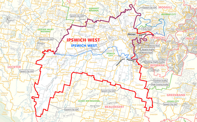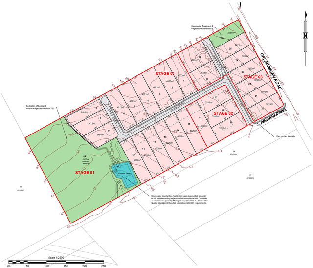
Around five years ago, Ipswich City Council approved a rural residential style subdivision on a 16 hectare block at the corner of Caledonian Road and Pindarri Drive at Mt Marrow.
It was a development defined by a number of significant overlays due to the presence of the endangered weeping paperbark (Melaleuca irbyana); designated areas of core koala habitat; bushfire prone areas, and that the allotments in Stage 1 would be on land where there had been historic underground mining.
As a result, the final approved lot layout was designed with ‘building envelopes’ a bid to preserve the environmentally significant vegetation.
And on one side of those building envelopes, a 20 metre area was designated as able to be cleared as a bushfire barrier.
The three stage, 28 lot subdivision was approved in 2020.
Stage 1 involved the dedication of 4.42 hectares as a bushland reserve and stormwater detention basin, and the 15 allotments above the historic underground coal mining activities.
And now the developer, Windmill Projects Pty Ltd, has applied to council for approval of the next step – a permit for the plan of development over the 15 lots including an updated consultant’s report on the former underground mining activities.
Giving a background to those activities, the report noted that … “underground coal mining has taken place under the site area by the Caledonian group of collieries between 1900 and 1950.
“The lots have been undermined on one or two levels along the upper Bruce Seam from the Caledonian No 3 Colliery and the lower Rea Seam from the Caledonian No 2 Colliery, respectively.
“The mining was by bord and pillar methods followed by total pillar removal (pillar extraction) along the upper Bruce Seam workings and partial pillar extraction along the lower Rea Seam. One of the lots is also located partially within the mine influence zone.
“The fully pillar-extracted Bruce Seam mining, which took place in the order of 15 metres below ground level, was found from the drilling and LiDAR check to have resulted in the closure of the mine voids and the completion of bulk subsidence in the 1940s.”
“The Rea Seam mining generally with 1.5 metre high flooded voids was found to be located in the 35 to 38 metre depth range.”
(Bord and pillar mining: Miners extracted coal along roadways or bords, with the coal between the bords acting as pillars holding up the roof. The outer pillars were then mined, leaving the roof to collapse in a controlled way as the miners retreated towards the exit.)
According to the consultant’s report … “subsidence from the pillar extraction along the upper Bruce Seam workings is indicated to be complete with some potential residual minor subsidence still possible.
“The previously identified old surface subsidence cracks were the result of the pillar extraction of the upper Bruce Seam workings dating back to the 1940s.
“The ground cracks and other depressional features were remediated where these were identified away from the council vegetation covenant.”
Following on from the report, the developer’s current application for a planning permit includes the recommendation that all residential buildings on lots in Stage 1 are of stump type construction.
“Slab on ground carports and undercroft garages can occur, where slabs are structurally isolated from the dwelling house structure.”
Council planners are currently reviewing the application.